High Demand Notice: Orders Shipped by Ground may Take 24-48 Hours to Dispatch. We Appreciate Your Patience!

Garmin

Garmin - Foretrex 901

(No reviews yet) Write a Review
SKU:
ACGM0001
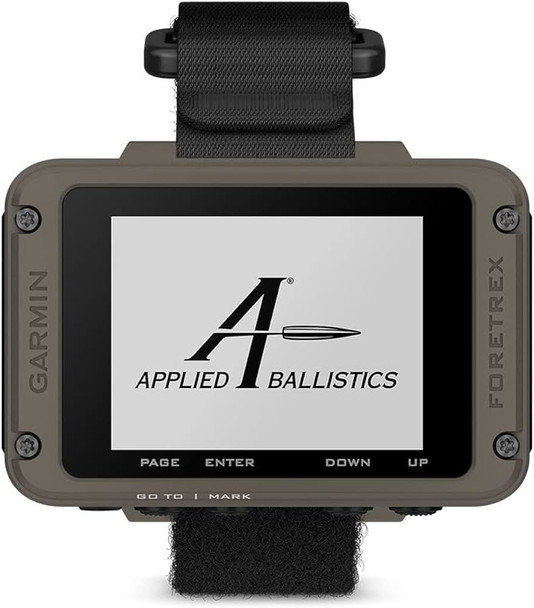
  • The image shows the Garmin Foretrex 901, which appears to be a wrist-mounted GPS device. This type of device is typically used by military personnel, hunters, and outdoor enthusiasts for navigation purposes. The screen displays the logo for "Applied Ballistics", suggesting that this particular model integrates ballistic calculations, which can be incredibly helpful for long-range shooters in determining how bullets will perform under various conditions. Garmin's Foretrex series is known for its durability and reliability in rugged conditions, making it a useful tool for those in demanding environments where hands-free navigation and quick access to ballistics data are essential.
  • Here we have the Garmin Foretrex 901 displayed with a screen showing ballistic calculations, such as elevation and windage adjustments, range to target, wind speed and direction, and direction of fire. This wrist-mounted device is providing critical shooting solution data that would be used by a marksman to adjust their rifle scope for a precise long-range shot. The displayed information takes into account environmental factors and ballistics data to help ensure accuracy over long distances. The compact and hands-free design is especially useful in scenarios where quick reference to such data is essential, without the need to manipulate a handheld device.
  • The Garmin Foretrex 901 is pictured again, this time showing how it is worn on the wrist. The ballistic calculations on the screen, such as elevation and windage, remain visible, underscoring how this device facilitates quick access to crucial data for shooters in the field. The design emphasizes practicality and ease of use, allowing for hands-free operation while engaging in shooting activities or tactical operations. It's clear from this perspective how the device integrates seamlessly into the user's gear, providing immediate information that can assist in making precise adjustments for long-range shooting.
  • In this image, the Garmin Foretrex 901 is shown with a different display mode, indicating the final distance to a waypoint or destination and the current speed of travel. This functionality would be particularly useful for navigation, allowing the user to track their movement and distance remaining to reach a specific location. The compass feature adds to the navigation capabilities, providing the user with direction orientation. This versatile device combines GPS navigation with ballistic calculation capabilities, catering to the diverse needs of outdoor, tactical, and shooting enthusiasts.
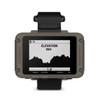
  • This image showcases the Garmin Foretrex 901's altimeter function, displaying the current elevation at 984 feet. The graphical representation likely indicates the elevation profile of a recent journey or the surrounding terrain, with the vertical axis representing elevation and the horizontal axis possibly representing time or distance. This feature can be particularly useful for hikers, climbers, or any outdoor activities where monitoring ascent and descent is important.
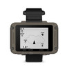
  • The image displays the Garmin Foretrex 901 with a map screen that shows a simple layout of a user's current location and the surrounding environment. Icons such as a pond, trails, and tracks are visible, providing a clear and concise navigation interface. The heading indicator at the top left shows that the user is facing 012 degrees North, which is a detail that adds to the navigational functionality of this GPS device. The map feature is an essential tool for outdoor navigation, helping users to orient themselves in the terrain and plan their movement accordingly.
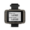
  • The image features the Garmin Foretrex 901 showing GPS coordinates in two different formats. The top section displays coordinates in the Decimal Degrees (DD) format, while the bottom section shows the same location in Degrees, Minutes, and Seconds (DMS) format. This function is useful for pinpointing exact locations for navigation, marking waypoints, or sharing location details with others, especially in outdoor or tactical scenarios where precision is crucial. The ability to switch between coordinate formats allows users to use the system that best suits their needs or preferences.
$599.99

Description

Garmin Foretrex 901 GPS Navigator | Durable Outdoor Navigation Device

Garmin Foretrex 901 - Advanced GPS Navigator for Outdoor Enthusiasts

The Garmin Foretrex 901 is a rugged and reliable GPS navigator, designed for the adventurous spirit. Featuring an easy-to-read monochromatic display, this device is equipped with multi-band GNSS and advanced navigation sensors, empowering you to explore with confidence.

Integrated Ballistics Solver

Enhance your shooting accuracy with the Applied Ballistics¨ software included in the Garmin Foretrex 901. Calculate long-range shots with precision and manage ballistic profiles seamlessly using the AB Synapseª Ð Garmin app on your compatible smartphone.

Military-Grade Durability

Tested to military standards (MIL-STD-810), the Foretrex 901 withstands harsh environmental elements including sand, dust, vibration, and shock. Its rugged design is complemented by an IPX7 water-resistant rating, ensuring reliability in various conditions.

Exceptional Battery Life

Experience prolonged expeditions with up to 100 hours of battery life in navigation mode, and extend it to 1000 hours in expedition mode. The device uses 2 field-replaceable AAA batteries (not included).

Tactical Features

The Garmin Foretrex 901 is equipped with tactical features like stealth mode to stop GPS data storage and sharing, and a kill switch for security. The jumpmaster mode is designed for military use, calculating high-altitude release points.

Advanced Navigation Sensors

Navigate confidently with advanced sensors including a 3-axis accelerometer, compass, and barometric altimeter. The upgraded multi-band GNSS ensures improved position accuracy.

Seamless Device Connectivity

Stay connected with smart notifications when paired with your compatible smartphone. Integrate with a compatible inReach¨ satellite communicator for direct messaging on your device.

General Specifications

  • Lens Material: Acrylic
  • QuickFitª Watch Band Compatible: Yes (26 mm)
  • Dimensions: 2.9" x 1.9" x 0.9"
  • Weight: 3.8 oz with batteries
  • Waterproof Rating: IPX7
  • Military Standard: MIL-STD-810 (thermal, shock, water)
  • Display Type: Monochrome MIP
  • Display Size: 2.2" diagonal
  • Display Resolution: 320 x 240 pixels
  • Battery Type: 2 AAA batteries (not included)
  • Battery Life: Up to 100 hours (GPS Mode), Up to 1000 hours (Expedition Mode)
  • Interface: USB-C
View AllClose

Additional Information

Material:
Plastic
Color:
Black
Model / Type:
D.O.P.E.
View AllClose